

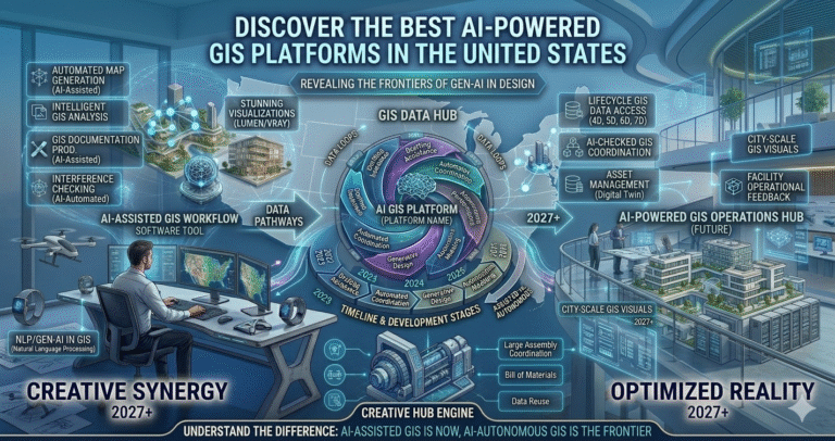
In an era where digital transformation reigns supreme, geospatial data has become a cornerstone for informed decision-making across various sectors. From urban planning to environmental conservation, Geographic Information Systems (GIS) have evolved dramatically, finding new strength with the integration of artificial intelligence. The synergy between AI and GIS promises not only enhanced data analysis but also unprecedented predictive capabilities.
But the question looms: what are the best AI-powered GIS platforms that are leading this transformation in the United States? Navigating through the myriad of options can be overwhelming, especially when each platform boasts unique features and strengths. This blog post will serve as your guide to the most innovative and efficient AI-driven GIS platforms available today. Whether you’re a tech enthusiast, a business strategist, or a digital cartography aficionado, you’ll discover how these advanced systems are reshaping landscapes and enhancing our understanding of the world with pinpoint accuracy and insightful foresight. Join us as we delve into the frontrunners that are revolutionizing the field and learn what makes them stand out in the competitive U.S. market.
Esri’s ArcGIS platform remains the dominant force in GIS, and by 2026 its AI integration has matured into one of the most comprehensive ecosystems for GeoAI. ArcGIS incorporates AI across desktop (ArcGIS Pro), cloud (ArcGIS Online), and enterprise deployments, with features like AI Assistants (beta in Feb 2026), generative Arcade expressions via natural language, trusted AI principles (security, fairness, transparency), and agentic components in the Maps SDK for JavaScript.
Key 2026 advancements include:
Esri emphasizes “Trusted AI” with risk evaluations, privacy safeguards, and accountability—critical for government and enterprise users. In urban planning, ArcGIS AI enables predictive modeling for growth patterns; in environmental work, it automates change detection in satellite imagery. ArcGIS Pro’s AI capabilities power mapping intelligence, while ArcGIS Online’s February 2026 updates added smarter content management and richer imagery options. For U.S. users, seamless federal compliance and extensive partner network make ArcGIS the go-to for mission-critical applications. While not the cheapest, its depth, community support, and continuous AI investment position it as the benchmark for AI-powered GIS in 2026.
Google Earth Engine (GEE) combines a multi-petabyte catalog of satellite imagery with planetary-scale analysis, and by 2026 its AI capabilities—branded as Google Earth AI—have expanded significantly. GEE excels in environmental monitoring, climate analysis, deforestation tracking, and disaster response through foundation models and cross-modal reasoning.
2026 highlights include:
GEE’s strengths lie in free access for non-commercial research, massive data archive (Landsat, Sentinel, MODIS), and JavaScript/Python APIs for scalable processing. U.S. agencies like NASA and USGS heavily rely on it for Earth observation. In 2026, new AI tools unlock insights from imagery without manual labeling—e.g., automatic flood mapping or crop yield prediction. Challenges include quota limits for heavy users and learning curve for non-coders, but its environmental impact (e.g., tracking wildfires, sea-level rise) makes GEE indispensable for sustainability-focused GIS in the U.S.
CARTO has emerged as a leader in cloud-native, agentic GIS by 2026, with its Agentic GIS suite making spatial analysis accessible via natural language. Integrated with major data warehouses (Snowflake Cortex AI, Databricks Mosaic AI, Oracle Generative AI), CARTO turns spatial data into instant insights without deep GIS expertise.
Key 2026 features:
CARTO excels in location intelligence for business (retail site selection, logistics optimization) and public sector (urban mobility, environmental equity). Its AI Agents automate repetitive analysis, enabling non-experts to derive value. In the U.S., CARTO’s cloud-first approach and partnerships with Snowflake/Databricks make it ideal for data-heavy organizations seeking scalable, governed GeoAI without heavy infrastructure.
ArcGIS Pro, Esri’s flagship desktop GIS, integrates AI deeply in 2026 for advanced mapping intelligence. It supports deep learning workflows, GeoAI frameworks, and assistants for expression generation and task automation.
Standout 2026 elements:
ArcGIS Pro excels in detailed cartography, 3D visualization, and enterprise workflows—perfect for U.S. government, utilities, and research. Its AI accelerates classification, prediction, and pattern recognition while maintaining rigorous standards for regulated industries.
Mapbox leads in developer-focused, AI-enhanced mapping in 2026, with Location AI, conversational maps, and MCP (Model Context Protocol) enabling geospatial reasoning for agents and apps.
2026 innovations:
Mapbox powers apps in logistics, automotive (Toyota integration), and telco—strong for U.S. mobility and delivery sectors needing real-time, AI-contextualized maps.
Trimble’s GeoAI focuses on construction, mining, and field ops in 2026, with agentic AI, Trimble AI Studio (early 2026), and integrations across Tekla, Earthworks, and Unity.
Core capabilities:
Trimble excels in U.S. infrastructure and heavy civil projects, using GeoAI to boost productivity and connect office-to-field workflows.
Autodesk InfraWorks leverages Autodesk AI for conceptual infrastructure design in 2026, with generative capabilities, predictive modeling, and integration with Civil 3D/Revit.
2026 highlights:
InfraWorks shines in U.S. civil engineering for rapid prototyping and sustainable design exploration.
TerraSeer specializes in predictive spatial analytics, using AI for urban growth modeling, risk assessment, and scenario simulation—popular in U.S. planning and insurance.
Features include:
TerraSeer empowers data-driven foresight in zoning, conservation, and hazard mitigation.
AI advancements in GIS by 2026 include agentic systems, foundation models for remote sensing, natural language interfaces, and predictive analytics at scale. Challenges remain: data bias, privacy, explainability, compute costs, and integration with legacy systems.
Future prospects:
In the U.S., expect tighter government adoption (USGS, FEMA) and enterprise scaling via cloud partners. AI will make GIS more accessible and predictive, transforming decision-making across sectors.
The U.S. leads in AI-powered GIS innovation, with platforms like ArcGIS, Google Earth Engine, CARTO, Mapbox, Trimble GeoAI, Autodesk InfraWorks, and TerraSeer driving transformation. These tools blend massive geospatial data with intelligent analysis—enabling faster, smarter decisions in planning, environment, infrastructure, and beyond. As AI matures, the future holds even more autonomous, predictive, and accessible geospatial intelligence—reshaping how we understand and shape our world. You can check out our ESRI ArcGIS Course